Satellite monitoring
If you are a company, contribute to reforestation or ecosystem restoration with our platform and track the progress of planted and protected areas via our Satellite Monitoring System.
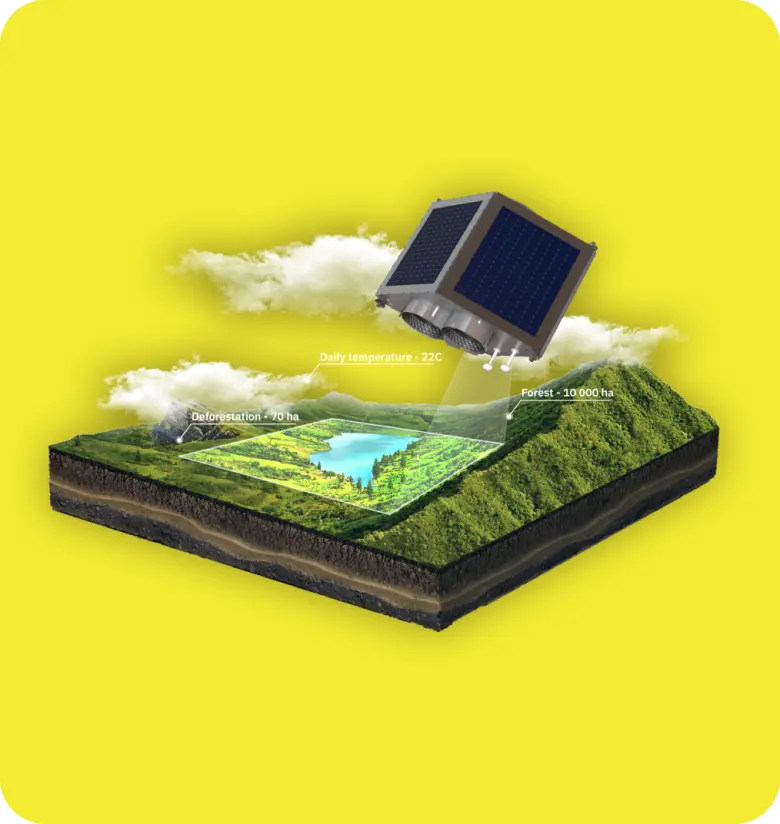
Our powerful satellite monitoring tool offers detailed insights into forests and restored ecosystems. It covers the growth status of vegetation, detects aging or stressed areas, and identifies diseases by analyzing nitrogen concentration in leaves. Additionally, it assesses photosynthetic activity based on chlorophyll levels and highlights regions experiencing water stress. The tool also gauges how effectively vegetation absorbs and reflects solar radiation, detects degraded or infertile soil, and more. The user guide, attached for reference, details these features. The Vegetation Indices, including NDVI, NDRE, MSAVI, and RECI, play a crucial role in monitoring health across different stages. Moisture Indices like NDMI help interpret water stress levels. The tool also provides basic layers like Elevation and Slope indices, historical data since 2015, images every 5 days, soil moisture penetration of 7 cm, precipitation forecasts up to 14 days, and historical weather data from 2008. The "Field Leaderboard" allows users to preview and filter sites based on various parameters. Our team is available for tailored analysis and reporting.